Welcome to FORE Institute of Drone
Technology and Research(FIDTR).
Become DGCA certified drone pilot
Welcome to FORE Institute of Drone
Technology and Research(FIDTR).
Become DGCA certified drone pilot
05 Days DGCA Approved Drone Pilot
At FIDTR, we offer a comprehensive 5-day Drone Pilot Training Program, approved by the DGCA.
Our Trainer
Our team’s commitment to excellence and innovation ensures that every student receives
personalized instruction and support.
Remote Pilot Certificate (RPC)
Our program is in full compliance with DGCA regulations, ensuring you meet all the requirements for the RPC.
ABOUT US
FORE Institute of Drone Technology and Research (FIDTR) is promoted by the Foundation for Organizational Research and Education (FORE). It was incorporated in 1981 as a not-for-profit organisation and is committed to the advancement of management education, research, training, and consultancy.
FORE Institute of Drone Technology and Research (FIDTR), a sister organisation of Delhi’s most premier business school, namely FORE SCHOOL OF MANAGEMENT, has partnered with Delhi Flying Club. The Delhi Flying Club (DFC) was established in May 1928, is a pioneer trainer of aviators in India and has trained numerous pilots and engineers.
Our New Branch
We are excited to expand our reach in Rajasthan with the opening of a new FIDTR branch at Shri Khushal Das University, Hanumangarh! This strategic location brings our DGCA-approved Drone Pilot Training closer to students and aspiring drone professionals in the region. With a focus on practical learning and skill development, this new branch aims to provide cutting-edge training to meet the demands of India’s rapidly growing drone industry.
Address - Shri Khushal Das University - 7STG, Suratgarh Road, Hanumagarh, Rajasthan-335801
Program Highlights
What we can do
- Surveillance, Monitoring & Law Enforcement
- Surveys & Mapping of Geographical Areas
- Disaster Management / Search & Rescue
- Agriculture, Aquaculture & Forestry Industries
- Aerial Cinematography, Journalism & Photography
- Logistics & Cargo Delivery
Drones are transforming surveillance, monitoring, and law enforcement by providing real-time aerial views of vast areas. Equipped with cameras and sensors, they help monitor large crowds, detect criminal activities, and track suspects, reducing the need for on-ground personnel. In law enforcement, drones are used for search-and-rescue operations, traffic management, and crime scene analysis, offering quick data collection and reducing human risk. Their ability to capture high-resolution images, operate in dangerous environments, and provide 24/7 monitoring makes drones a crucial tool for enhancing public safety, ensuring security, and improving the overall efficiency of law enforcement agencies.
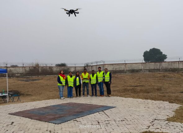
Drones are revolutionizing the field of surveys and mapping, offering a fast, efficient, and cost-effective solution for geographical analysis. Equipped with advanced cameras and sensors, drones can capture high-resolution images and detailed topographic data, enabling precise mapping of large areas. Their ability to access difficult terrains, such as mountains or forests, makes them invaluable for environmental monitoring, urban planning, and infrastructure development. Drones also reduce the time required for data collection, enhance accuracy, and improve safety by eliminating the need for human presence in hazardous areas. This technology is transforming how we understand and manage geographical landscapes.
Drones are transforming disaster management, search, and rescue operations by providing rapid, real-time aerial assessments of affected areas. Equipped with cameras, thermal sensors, and GPS, drones can access dangerous or hard-to-reach locations, offering critical information to rescue teams. They quickly survey disaster zones, identify stranded individuals, and assess damage, enhancing decision-making and reducing response time. In search and rescue, drones can cover large areas, locate missing persons using infrared technology, and deliver essential supplies. Their versatility, speed, and ability to operate in hazardous conditions make drones invaluable tools for modern emergency response efforts.
Drones are revolutionizing agriculture, aquaculture, and forestry industries by enhancing efficiency and sustainability. In agriculture, drones monitor crop health, apply pesticides, and assess soil conditions, reducing labor costs and improving yield. In aquaculture, drones help manage fish farms by monitoring water quality, feeding patterns, and fish stock health from above. In forestry, drones are used for forest mapping, tracking tree health, and identifying areas affected by disease or fire. Their ability to gather real-time data, cover large areas, and minimize environmental impact makes drones a valuable tool for advancing precision farming and resource management across these industries.
Drones have revolutionized aerial cinematography, journalism, and photography by offering innovative perspectives previously limited to helicopters and cranes. In cinematography, drones enable filmmakers to capture sweeping landscapes and dynamic action scenes with greater precision and at lower costs. Journalists use drones for real-time reporting in difficult-to-reach areas, providing aerial views of events like natural disasters or protests. Photographers benefit from drones’ ability to capture stunning high-angle shots, transforming landscapes and cityscapes. Their versatility, affordability, and ability to capture unique angles have made drones an essential tool in these fields, enhancing storytelling and visual expression.
The use of drones in logistics and cargo delivery is revolutionizing the industry by offering faster, more efficient transportation solutions. Drones can bypass traditional traffic routes, delivering packages directly to destinations in record time. They are especially valuable for last-mile deliveries, reducing costs and improving service in remote or hard-to-reach areas. Additionally, drones can carry small to medium-sized packages, streamlining the supply chain and enabling companies to meet customer demand quickly. As technology advances, drones are becoming a sustainable option, reducing carbon emissions and contributing to a greener, more efficient logistics network.
Pick A Course To Get Started
Authorised Training Partner
1. PDRL Certified Drone Professional (PCDP).
2. PDRL Certified Drone Solutions Expert (PCDSE)
3. PDRL Certified Drone Solutions Architect(PCDSA)
What Our Students Have To Say
At Fidtr Drone Institute, we take pride in empowering our students with the skills and knowledge to excel in the world of drone technology.
At Fidtr, I gained not only theoretical knowledge but also practical exposure that made all the difference in my understanding. Thanks to Fidtr, I landed my dream job in just a few months!
Vansh
StudentFidtr Institute exceeded my expectations with its state-of-the-art labs and experienced faculty. The course content was comprehensive, and the real-world case studies were invaluable. I feel much more prepared for the industry now, thanks to the guidance and support I received here.
Santanu Ghosh
StudentI enrolled at Fidtr Institute, and it was a game-changer for me. The instructors were not only knowledgeable but also very approachable. The hands-on projects helped me build confidence and practical skills that I’m already applying in my job. I highly recommend Fidtr to anyone looking to enhance their career!
Ashwin
StudentI had an amazing experience at Fidtr Institute. The focus on career development and skill-building really set this institute apart.I secured a great job soon after completing my course.
Sidharth Upadhyay
StudentFIDTR Institute has been a life-changing experience for me. The curriculum is well-structured, and the instructors are incredibly supportive. I gained both theoretical knowledge and practical skills that have helped me excel in my career.
Avranil Das
StudentCourse Instructors
Jane Seymour
UI DesignerEdward Norton
Web DeveloperPenelope Cruz
Digital MarketerJohn Travolta
WordPress ExpertLearn with Our Partners
Get News with FIDTR
Know About RPAS Classification
An unmanned aerial vehicle (UAV), commonly known as a drone, is an aircraft without any human pilot, crew, or passengers on board. UAVs are a component of an unmanned aircraft system (UAS), which includes adding a ground-based controller and a system of communications with the UAV. The flight of UAVs may operate under remote control by a human operator, as remotely-piloted aircraft (RPA), or with various degrees of autonomy, such as autopilot assistance, up to fully autonomous aircraft that have no provision for human intervention.